Master of Applied Geospatial Information Systems and Technologies

The curriculum offers coursework that brings academic rigor to topics required for GIS professionals in business, engineering, planning, data and information management, as well as government and non-profit organizations.  With its emphasis upon spatial data analysis and computer programming techniques, the MAGIST program prepares students for professional success in specialized and highly skilled positions within the GIS and geospatial technology industries.

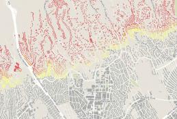
Fire Hazard of Every Building in California: An Interactive Map

Recent wildfires in Southern California, most notably the Saddleridge Fire in the San Fernando Valley and the Sandalwood Fire in Riverside County, serve as reminders that many communities in the state are vulnerable to wildfire hazards.  While all Californians should be adequately prepared for disasters such as earthquakes and wildfires, some communities are more vulnerable to wildfires than others.

Entering the GIS Profession: Education and Competencies

As an organization, Geospatial @ UCLA has several primary objectives, among which are (1) fostering the advancement of geographic information science (GIScience) through research, development, and scientific education, and (2) offering educational programs that prepare participants for professional success in the expanding market of jobs focused upon the use and development of geographic information systems (GIS).  The former objective focuses upon the development and application of spatial science research methods to better understanding phenomena in the world around us, a